Maps serve many purposes, including displaying knowledge of place as well as informing decision making. Many examples are available in the map gallery:
- The AMN Shape Tool – visualize and share your shapes.
- The Living Atlas – an interactive thematic atlas focused on the changing geography of a place, over time.
- Aboriginal Maps – made by Aboriginal organizations – Tribes, Bands, Nations, etc. and placenames
- Aboriginal Maps – Other – made of Aboriginal peoples: historical maps, collections of maps, government maps, overview maps, etc.
- Dynamic Maps – interactive, on-line maps
- Heiltsuk First Nation Map Atlas
- Land and Resource Maps – not specifically Aboriginal
- Mapping the Clayoquot Sound Scientific Panel’s Recommendations
- Stó:lô-Coast Salish Historical Atlas – recently updated!
- Treaty Maps – maps related to Treaties
- User Images – a gallery to display your maps
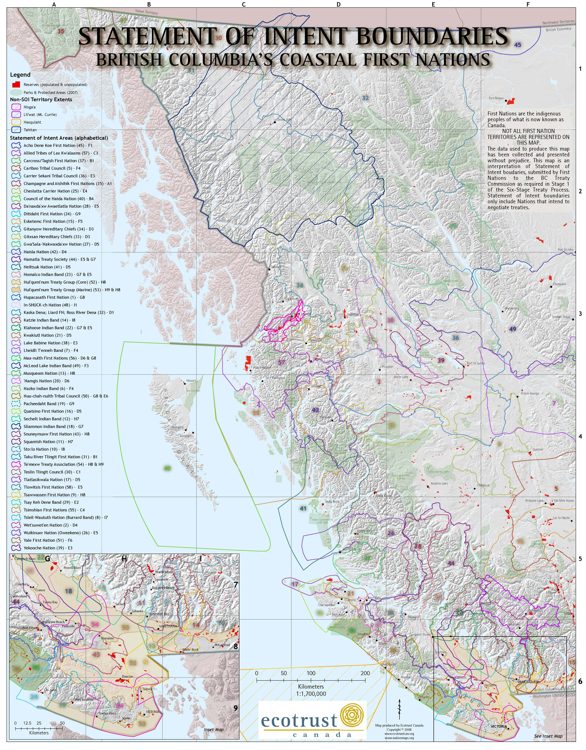
Boundary Chaos! This map illustrates the First Nation Statement of Intent boundaries on the coast of B.C. Such images provide an interesting insight into the interface between western mapping ideas on one hand, and the complexity of aboriginal land use on the other. Created by Ecotrust Canada.