These maps show a trapline located in the North Okanagan Highlands of British Columbia. They were created for Ray Derickson by Ecotrust Canada.
All maps produced here are provided for educational purposes only. The content, map information, and graphical elements remain the property of the First Nation or Inuit group or organization copyright holder credited. Map content or information may not be copied, modified, or used for any planning, commercial, legal or negotiation purposes without the express prior written permission of the copyright holder. Restrictions on the non-commercial, personal or educational reproduction of these materials or graphical elements may apply. Please refer to the specific copyright holder for information regarding copyright ownership, restrictions on reproduction, and any additional information.
Click on a thumbnail below to open a PDF version of the map in a new window.
|
Northwest Quadrant  |
Northeast Quadrant  |
|
Southwest Quadrant 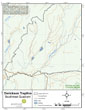 |
Southeast Quadrant  |
|
Landcover  |
Forest Age Class 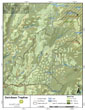 |