Amazon natives use Google Earth, GPS to protect rainforest home
Rhett A. Butler, mongabay.com
November 14, 2006
Original Story Here:
http://news.mongabay.com/2006/1114-google_earth-act.html
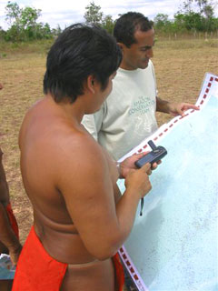
Deep in the most remote jungles of South America, Amazon Indians (Amerindians) are using Google Earth, Global Positioning System (GPS) mapping, and other technologies to protect their fast-dwindling home. Tribes in Suriname, Brazil, and Colombia are combining their traditional knowledge of the rainforest with Western technology to conserve forests and maintain ties to their history and cultural traditions, which include profound knowledge of the forest ecosystem and medicinal plants. Helping them is the Amazon Conservation Team (ACT), a non profit organization working with indigenous people to conserve biodiversity, health, and culture in South American rainforests.
ACT was founded by Mark Plotkin, an accomplished author and renowned ethnobotanist, who has spent much of the past 20 years with some of the most isolated indigenous groups in the world. ACT is active in the Amazon, one of the few places where indigenous populations still live in mostly traditional ways. However, like the Amazon rainforest itself, this is rapidly changing. As forests fall to loggers, miners, and farmers, and the allure of western culture attracts younger generations to cities, extensive knowledge of the forest ecosystem and the secrets of life-saving medicinal plants are forgotten. The combined loss of this knowledge and these forests irreplaceably impoverishes the world of cultural and biological diversity.
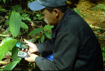 Memberof the Union of Yagé Healers of the Colombian Amazon (UMIYAC) using GPSto map a section of forest. Photo courtesy of ACT. |
ACT has pioneered a novel approach to address these problems by enabling Indians to monitor and protect their forest home while passing on their cultural wealth to future generations. ACT is working in partnership with local governments to train Indians in the use of GPS and the Internet to map and catalog their forest home,helping to better manage and protect ancestral rainforests by monitoring deforestation and preventing illegal incursions on their land. At the same time the efforts are strengthening cultural ties between indigenous youths and their parents and grandparents.
Googling for forest conservation
While Indian reservations are nominally protected in parts of Brazil — in fact more than 26 percent of the Brazilian Amazon has been set aside in such reserves — in reality Indian lands in northern South America are suffering from encroachment, especially from illegal miners looking to exploit the region’s gold deposits. Since the early 1990s the region that includes parts of French Guiana, Guyana, Venezuela, Suriname, Brazil, and Colombia has witnessed a gold rush that has brought tens of thousands of informal miners across lightly patrolled — and sometimes unpatrolled — borders. These mines have wreaked havoc on the local environment, causing deforestation, mercury pollution, and sedimentation of otherwise pristine rivers. The influx of miners has social consequences as well, ranging from violence between miners and indigenous populations to the introduction and spread of diseases like malaria and AIDS. The situation is so problematic that the Association for Tropical Biology and Conservation (ATBC), the world’s largest scientific organization devoted to the study and protection of tropical ecosystems, recently passed a resolution calling upon governments to take action to stop this illegal and destructive mining.
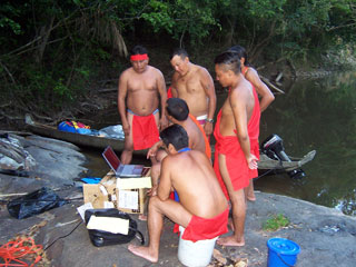 GPS data gathering on a mapping expedition in the Amazon. Image courtesy of ACT. |
Due to the scale of mining operations and the remoteness of the area, illegal mining has been exceedingly difficult to detect. A clandestine airstrip in cleared forest or a series of riverside sluice boxes can be nearly impossible to pinpoint on the ground, given the vastness of the Amazon. But technology is changing the picture. Google Earth and GPS are proving to be key tools in battling deforestation and helping Indians protect their lands.
Indians, who have access to the Internet at the ACT offices in several locations in northern South America, use Google Earth to remotely monitor their lands by checking for signs of miners.
“Google Earth is used primarily for vigilance,” Vasco van Roosmalen, ACT’s Brazil program director, said in an interview with mongabay.com. “Indians log on to Google Earth and study images, inch by inch, looking to see where new gold mines are popping up or where invasions are occurring. With the newly updated, high-resolution images of the region, they can see river discoloration which could be the product of sedimentation and pollution from a nearby mine. They are able to use these images to find the smallest gold mine.”
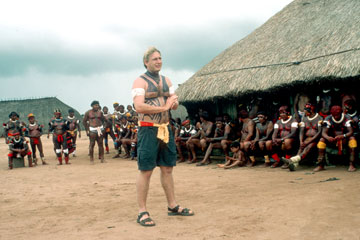
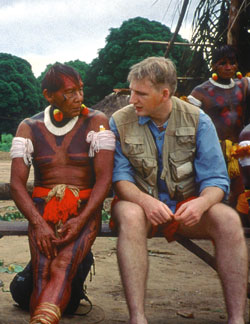 Vasco van Roosmalen, ACT’s Brazil program director, with a Xingu elder in the southern Amazon. Image courtesy of ACT.
|
Once the Indians pinpoint suspect areas using Google Earth, they note the coordinates, then go on foot patrol to investigate further or mark the spot for future airplane flyovers, where five to six Indians go up with government officials to scout for illegal incursions. Van Roosmalen says that without the aid of satellite imagery, flyovers can be of limited effectiveness due to the extent of the forest.
“The high-resolution images make it a lot easier to actually find these areas,” said Van Roosmalen. “When Google Earth updated these images earlier this year with higher resolution versions, we could find nearly all the disturbances in the forest. Our guys have been finding gold mines we didn’t know about at all.”
Van Roosmalen said that ACT has spoken with Google Earth about the project.
“We made a presentation earlier this year explaining how we use the images,” Van Roosmalen recounted. “We offered the Google Earth team a list of coordinates where it would be helpful to have sharper images. We also discussed the possibility of finding ways to include the Indians’ nonproprietary data, as a layer with Indian names, on Google Earth.”
Beyond the forest-monitoring capabilities, Google Earth and more generally the Internet, is also helping to strengthen bonds between indigenous children, hungry for technology, and their parents, who are interested in protecting their homeland.
“We have three Indians working in Macapá, the state capital,” Van Roosmalen explained. “The kids are spending time on the computer now and learning very quickly. They are helping their parents use Google Earth to find gold mines near the borders of the indigenous reserve. Not only are the kids having fun with it but they are helping preserve the forest.”
"This is the perfect combo of western technology and indigenous custom and know-how," said Plotkin, president of ACT. "We’ve got guys painted red and nothing else, walking through the jungle with GPS units mapping their land. That’s the sweet spot, the best of both worlds."
Two headed invisible jaguars here
"Westerners maps in three dimensions: longitude, latitude, and altitude," explained Plotkin. "Indians think in six: longitude, latitude, altitude, historical context, sacred sites, and spiritual or mythological sites, where invisible creatures mark watersheds and areas of high biodiversity as off-limits to exploitation."
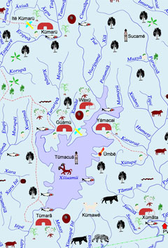 A model map created by Indians in Brazil. Image courtesy of ACT. |
Their maps are also meticulously detailed, including virtually everything associated with a place.
"Indians mark where they get materials for houses, bamboo, specific vines, places where they find honey and wood for canoes, anything they eat in terms of palm nuts, brazil nuts, Açaí — rich palmfruit. For example we’re working with the Wayana, a warrior tribe. They have marked two specific parts of the forest where they can find wood hard enough for arrow points. They’ve marked another point on the other side of the reserve where they get hollow wood to craft the arrowshaft," added van Roosmalen.
The Indians also chart the distribution of medicinal plants –they use hundreds — but for security reasons, some highly coveted medicinal plants are not published. In the past there have been problems with biopiracy where outsiders trespass on lands to illegally collect these plants for export. The Indians saw nothing in return.
In addition to plants, the Indians mark all the places the see animals, including game animals and mythological animals that have deep spiritual meaning.
"On one of the maps the Kamayura had drawn a two-headed animal, so I asked the shaman what it was," recalls Plotkin. "’A two-headed invisible jaguar’ he told me. So I asked if he’d ever seen one. ‘No they are invisible and dangerous so we don’t go there,’ he said. Later I learned that the area marked with the invisible jaguar was a strict no-hunting zone, which was preserved to ensure a breeding refuge for forest wildlife. This was his way of saying that it was a protected area where hunting was not allowed."
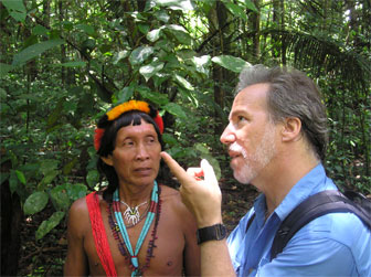 Plotkin with Amasina, a shaman of the Trio tribe in Suriname. Photo courtesy of the Amazon Conservation Team.
|
There are good reasons that Indians say certain sites are sacred. Watersheds, which ensure clean drinking water, are off-limits to disturbance as are areas of high biodiversity and places with sacred plants. Indians don’t want these places over-exploited.
Besides indicating the location of resources, villages, and geographical features like rivers and creeks, the mapping process has helped reestablish bonds between generations in a society where culture is at risk of extinction.
"The Tumucumaque map has over 2000 Indian names that never before had been registered," said van Roosmalen. "This is extremely important because behind each name is a story that can serve as a tie to the land."
"For example when we did one of the first mapping projects, Indians went out into villages and forests to get the names of the places. When they returned, they said it was taking longer than expected because the elders spent half an hour telling them the story behind the name, before they revealed the name. Well, some of these guys thought this through and asked us for tape recorders so they could record these stories, transcribe them into their language, and make a book with the stories behind the names on the map. Now, for the first time, they have educational material about their culture."
"Look, you want to map your land so you head into the forest with GPS and mark your waypoints and your routes, but the monkey at the end of the creek isn’t going to tell you the name and history of a place. All the technology in the world is not going to explain to you the spiritual significance of a spot. No, it’s the old guy sitting at the back of the hut, the one you’ve ignored since you were a kid. He’s the one with the knowledge. All of a sudden these old guys are being appreciated as tremendous sources of knowledge by the younger generation, conservation organizations like ACT, and government agencies. Now they see the value of these elders when before no one cared."
In Brazil, Van Roosmalen says that the maps themselves are helping younger generations better understand the struggles of their parents and grandparents in the 1970s and 1980s to acquire rights to the land.
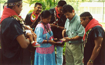 GPS Workshop for Union of Yagé Healers of the Colombian Amazon (UMIYAC) in Colombia. Image courtesy of ACT.
|
"The elders are dying. The younger generation hadn’t been learning about the stories of their ancestors or their ties to the land. There were no materials for the school. The main reason the elders asked for these maps was the huge responsibility to hold on to their lands. Their forefathers fought so very hard for these territories — not having ways to learn about this history, the younger generation is not interested in the land."
"Just last month a researcher told me, ‘I thought this land has always been ours. I didn’t know we fought so hard for it. Now I need to do a better job of managing it and protecting it.’"
The maps change all this — they make culture relevant to the new generation and present an easy way for the old generation to pass on their knowledge. Most importantly, the decision to make the maps was that of the Indians. Van Roosmalen says that ACT just comes in with the methodology, but doesn’t tell the Indians what to map.
"They know they are making these maps for themselves. They decide what goes into these maps," he says. "The maps empower them and make them more self-reliant."
The maps also have important legal implications for Indians. Maps can be used to establish land rights. For example, says van Roosmalen, in Suriname where there are no indigenous land rights, the maps serve as a very basic tool to help them get rights to their land. In Brazil, vast quantities of land are set aside for Indians but don’t have title, meaning that if there is a change to the constitution, they could lose their land.
"A common question from politicians and developers is ‘Why do so few Indians need so much land?’" said van Roosmalen. "When you can illustrate it with these detailed maps — showing that they are using it for all their various purposes — it’s a much more powerful argument than just having a blank map with a green rectangles drawn on it."
Eyes and ears for the government
The maps and Indian involvement also pay dividends for the Brazilian government, concerned about illegal activities and border security. Van Roosmalen says the government has taken an active interest in training Indians in GPS so they can monitor forest areas.
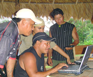 Keenge downloading GPS mapping data in Suriname. Image courtesy of ACT. |
"Brazilian security agencies are very interested in information from indigenous park guards. These guys know these areas better than anyone — they are the eyes and ear on the ground. With GPS and the Internet, Indians now have the means to pass on information in a form that is useful to the government. Before this technology was available, an Indian might come upon a new airstrip or hear a plane overhead, but he would have no way to communicate with officials. He might know the traditional name for that place but there was no map to identify its location. Now he’s able to plot the point on the GPS and look it up on Google Earth. Today he can hand in an entire report with all the supporting information. The government has even linked a database updated by indigenous park guards to national security databases."
Indigenous people can save rainforests and biodiversity
The involvement of Indians in monitoring could play a key role in rainforest conservation efforts. Research has found that indigenous reserves have lower deforestation rates than unprotected regions and observations cited by Plotkin, suggests that indigenous reserves may preserve biodiversity and forest cover better than traditional protected areas.
|
Plotkin points to Tumucumaque indigenous reserve on the Suriname border as an example.
"Tumucumaque indigenous reserve is inhabited by 2000 Indians and has one gold mine," he said. "Tumucumaque national park is about the same size, maybe a little smaller, on the border of French Guiana. It’s officially inhabited by no one has between 10 and 25 gold mines, depending on who you believe. The fact is where you have people with poison-tipped arrows it’s a lot less attractive a proposition to destroy that territory and the one next door."
Plotkin says that Brazil’s extensive indigenous reserves -which cover more than a quarter of the Brazilian Amazon — have more conservation potential than the country’s poorly patrolled national parks which cover less than 7 percent of the territory.
"If we can help Indians look after their lands as well as watch over after neighboring nature preserves, we’ll have tremendous conservation leverage," said Plotkin. "It’s our strong belief that the people who best know, use, and protect biodiversity are the indigenous people who live in these forests," said Plotkin.
Plotkin adds that conservation initiatives would bebetter-served by having more integration between indigenous populations and other forest preservation efforts since "you can’t have rainforest Indians without the rainforest. The best way to protect ancestral rainforests is to help the Indians hold on to their culture, and the best way to help them hold onto their culture is to help them protect the rainforest. "


