In recent months, many sources of digital data have become available for free for geographic information systems (GIS) users and non-users nationally. Natural Resources Canada, the Manitoba Government and the Ontario Government have opened their digital doors, enabling free access to numerous sources of geospatial data and metadata.
To read more about these initiatives, see the articles below:
- Launch of the GeoBase Portal Moving Towards a New Geospatial and Mapping Environment
- Government of Manitoba Opens Doors to Spatial Data
- Ontario Geospatial Data Exchange
To find out more about other sources of digital data, click here.
| Launch of the GeoBase Portal Moving Towards a New Geospatial and Mapping Environment |
Message, to NRCan employees from Dr. Irwin Itzkovitch, Assistant Deputy Minister, Earth Sciences Sector – (Nov 2003)
I am very pleased to announce the public opening of the GeoBase portal located at www.geobase.ca. November 19, 2003, designated as International GIS Day, seems the appropriate occasion to launch the GeoBase portal, which will provide Canadians with access to quality and unique geospatial data at no cost and with unrestricted use.
The GeoBase portal is the first output stemming from the GeoBase initiative, a coalition of federal, provincial and territorial governments, which is overseen by the Canadian Council on Geomatics. GeoBase aims at ensuring the provision and access to a common, up-to-date, and maintained base of quality geospatial data for all of Canada. Version 1 of the GeoBase portal offers users access to sets of data related to: road network, landform/topography, place names, administrative boundaries, geodetic network and satellite imagery.
NRCan plays a leadership role in GeoBase and is a main contributor to the establishment of the GeoBase portal and contents. It also operates the portal. The GeoConnections Program is a key contributor to the GeoBase initiative.
GeoBase benefits all Canadians by providing a federal, provincial and territorial approach to advancing and stimulating the geomatics and other technology sectors. It facilitates the exchange of technical knowledge between industry and governments and improves decision-making by all Canadians by providing a reliable and valuable source of geospatial information.
The Earth Sciences Sector and his partners are proud to invite you to visit the GeoBase portal and to see the results of a successful collaborative approach in the geomatics field.
Irwin Itzkovitch
Assistant Deputy Minister
Earth Sciences Sector
| Government of Manitoba Opens Doors to Spatial Data |
By Glenn Letham, Founder/Managing Editor, GISuser.com (editor@gisuser.com), Feb. 25, 2003
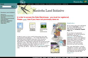
The Manitoba government has gone against tradition and opened the doors to it’s data repository, something Canadians have been requesting for many years. In a radical departure from previous business models, Manitoba is providing all of its geospatial data free of charge for unrestricted use. Enter the Manitoba Land Initiative (mli.gov.mb.ca), a web portal developed for GIS users and non-users enabling online access to geospatial data and metadata. The data warehouse has been developed under the Manitoba Land Initiative (MLI) which is an interdepartmental committee of data producing departments.
 |
|
Users are required to register and accept a user agreement prior to gaining access to the repository. A simple registration is required where users must provide their name, contact information, and establish a username and password.
|
Hartley Pokrant, Director Information Technology Services Branch has informed GeoCommunity that the data repository contains Provincial GIS data holdings including topographic data, base maps, soils maps, land use mapping, cadastral data, forest inventory, digital imagery, geology maps, community base maps, all administrative boundaries, quarter section grids, geographical names, water resource mapping, road maps, and other layers. All data files are supported with two popular download formats along with complete FGDC meta data files. In the near future, we will also be releasing our interactive map servers covering various interactive data themes.
Using my account, a quick look through the data holdings reveals that 1:20,000 topos can be easily accessed and downloaded in DXF or SHP format. Metadata is provided in a MS Word document and as a bonus, a sample GIF format is provided for viewing prior to download.
Free access to Manitoba’s geographic land related data is intended to improve resource management and decision making, and economic development opportunities for businesses, the general public, and academic institutions who can be hindered by high costs and restrictive use rules for spatial data. Complex licensing requirements and fees have been eliminated and substituted with a simple online registration process where the customer acknowledges the data disclaimer and user agreement.
The Canadian geospatial industry, particularly from the private sector, is likely going to embrace this effort as it will surely serve as a catalyst for change in policy in other provinces. Myself having first hand experience working in British Columbia, I can attest to the fact that accessing large-scale, free vector data and basemaps is no easy feat. Some time ago the Province of B.C. made available all of its 1:20,000 TRIM data as downloadable PDFs, a step in the right direction, however, falling short of what is required by the GIS user community. Experienced users and consultants familiar with Ministry websites, particularly those providing FTP access, can often “stumble” on to valuable data products. As a rule though, Provincial base mapping products are not publicly available. Perhaps the MLI will start a trend! At the National scale, Numerous data products are accessible via the popular GeoGratis website (http://geogratis.cgdi.gc.ca). Vector mapping data is available from GeoGratis in scales ranging from 1:50 000 to 1:30 000 000
Do you have any comments concerning this topic? Send them to Glenn
Related Weblinks: http://mli2.gov.mb.ca/
| Ontario Geospatial Data Exchange |
http://www.mnr.gov.on.ca/en/Business/LIO/index.html
Background
Government has long been aware of the need to provide better ways to share its geospatial data. Land Information Ontario (LIO) recently received approval from the Management Board of Cabinet to develop a data-sharing exchange which will better address this issue. The Ontario Geospatial Data Exchange (OGDE) will draw its members from all levels of government with a mandate in Ontario (the Federal Government, Ontario Government and municipalities). Membership is also available to First Nations and aboriginal communities as well as broader public sector entities such as conservation authorities, school boards, and post-secondary educational institutions.
Benefits
The Exchange will provide for the centralized sharing of spatial data, through an umbrella agreement among member organizations thereby:
- Reducing the administrative paperwork involved,
- Simplifying and streamlining access to member data,
- Reducing the potential for duplicate data collection and maintenance,
- Raising the awareness among members of the data which is available,
- Supporting the move towards the development and adoption of spatial data standards and,
- Allowing members to benefit from the efficiencies and economic opportunities which geographic information systems can introduce.
Funding the Initiative
Various Ministries of the Ontario Government have agreed to pay an annual levy in support of the Ontario Land Information Infrastructure initiative which includes the OGDE. In consideration of this levy, free access will be provided to Ontario Government organizations including Schedule I & III agencies. The Federal Government, municipalities and non-government members will all pay an annual fee (waived in the first year) to cover hardware, software and support costs. There is no charge for the data itself.
Guiding Principles
The expectation is that all geospatial datasets belonging to a member organization would be shared unless there is a legal, legislated or privacy reason not to do so. Members may specify restrictions on access by members to their sensitive or classified data.
As a condition of participation, members will be required to compile standardized metadata which will describe their data sets in the Ontario Land Information Directory (OLID). This process will make the data discoverable on the Internet. While members may elect to retain the responsibility of distributing their own data a central data warehouse facility, designated as the Ontario Land Information Warehouse (OLIW), has been established to facilitate standardized access by members.
Data which members borrow may only be used for internal, non-commercial purposes and cannot be redistributed. Any external, commercial or redistribution of borrowed data will require a separate license agreement and royalty fees may be incurred.
Retention of Intellectual Property Rights
The agreement establishing the Exchange allows members to retain full control of intellectual property rights relating to their data. Corrections made on another member’s data become the intellectual property of the owner of the dataset – unless the parties agree otherwise.
Equipping the Warehouse
To deal with this challenge LIO has fitted the Warehouse with two on-line tools capable of providing secure, two-way exchange of geodata between members of Ontario’s various data sharing alliances.
The Land Information Data Subscription Service (LIDS) allows members of accredited data-sharing alliances to use the internet to identify and borrow other member’s data. Developed with funding from the Federal Government’s GeoConnections program, LIDs not only simplifies the extraction of geodata, it also permits alliance members to subscribe to automatic updates of those data.