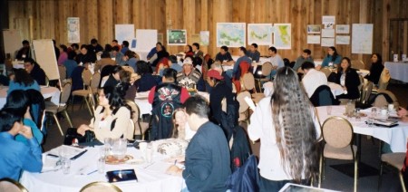
November 20, 2003, DUNCAN, B.C. – Some 120 aboriginal mappers from across North America and as far away as Malaysia and Panama met from November 20 to 21 for the third international GIS-mapping conference hosted by the Aboriginal Mapping Network (AMN). It was one of the largest gatherings of aboriginal mappers ever to take place in North America and demonstrated the leading role Canadian mappers and the AMN are playing internationally.
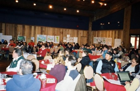 |
The conference, entitled “Mapping for Communities: First Nations, GIS and the Big Picture,” was held at the Quw’utsun’ Conference and Cultural Centre in Duncan, B.C. The response to the conference was great, showing how important mapping has become to First Nations today. The conference addressed current and key issues pertaining to aboriginal cartography. Aboriginal self-government, treaty negotiations and constitutional court cases have increased the importance of traditional-use and land occupancy mapping by First Nations. In the Supreme Court’s Delgamuukw ruling, aboriginal title was defined for the first time and oral history was given recognition as admissible evidence in court. One of the primary ways to present oral history is through maps, which have become a tool of empowerment for First Nations.
“Possession and control of cultural data [from maps] translates into considerable political power, at both the negotiating table and in court,” says Terry Tobias, in Chief Kerry’s Moose, a mapping and research guidebook published by Ecotrust Canada and the Union of BC Indian Chiefs.
The conference explored the kinds of mapping presently taking place in First Nations communities, from traditional use studies to land use planning and its applications. Delegates also addressed technical, cultural and methodological challenges.
An elder of the Cowichan Tribes, Dennis Alphonse, opened the conference with a prayer and welcome to their traditional territory. He spoke of the importance of mapping and the benefits of First Nations coming together to discuss these issues. The first day showcased community-mapping projects. The presentations were diverse, from the GIS (Geographic Information Systems) office of the Hul’qumi’num Treaty Group in Ladysmith, B.C., to the hand-drawn base maps of the Kuna people from Panama.
The Kuna’s presentation demonstrated how mapping is more dependent on people than technology. Without any high-tech know-how (particularly GIS), the Kuna generated beautiful maps created by their own community members that could be used to negotiate land tenure and rights.
 |
The second day focused on GIS and its uses as a tool in First Nations planning processes, education and capacity building. Several First Nations shared their experiences, including the GIS offices of the Tsleil-Waututh Nation in North Vancouver, the Sto:lo in Chillawack, the Cariboo Tribal Council in Williams Lake and the Suquamish Tribe in Washington state. Sinte Gleska University of Rosebud Reservation, South Dakota, and Moccasin Trail Solutions from the Six Nations in Ontario also presented ways of building capacity and learning through GIS.
Through the presentations and breakout sessions, a few key themes and concerns emerged. First, delegates identified the challenge of getting data into use in communities. Second, they discussed issues of GIS and data accessibility, including quality and cost. Third, delegates addressed education and how to undertake capacity building in meaningful ways. And finally, they identified the importance of ownership over maps to ensure mapping belongs to communities. Delegates also suggested a need to work toward making mapping reflect culture and community concerns better.
Rachel Olson, the conference coordinator, will work with the AMN Steering Committee to complete an evaluation of the network based on the discussions at the conference and further interviews with AMN participants. She will identify the role that the network could play in addressing the key issues and challenges. Rachel will also explore new ways for the AMN to link First Nations mappers to information and tools that they need.
Click here to read the proceedings from the breakout sessions and discussion.
|
Click to enlarge these photos:
|


Funding for this event was generously made possible by the International Development Research Centre and Ecotrust Canada.
 |
|