By David Carruthers and Bo Reid
The Heiltsuk Geographic Information Systems (GIS) Department was developed by the Heiltsuk Treaty Office in 1995. It is a great example of how First Nation Peoples can build capacity within their communities. By developing local skills and utilizing local resources, the Heiltsuk Nation is directly investing in the health of the community for today and the future.
Bo Reid is the manager of the Heiltsuk GIS Department. Through three years of training, he has had the opportunity to develop the necessary skills to manage various research projects that directly benefit the Heiltsuk in many areas such as:
- Linking information gaps between the different research departments, including fisheries, forestry and the cultural education centre;
- Producing maps that support the Heiltsuk Tribal Council, Heiltsuk Hemas (hereditary chiefs) and research directors in analyzing datasets for decision-making;
- Developing maps that are used as educational tools for community members and Heiltsuk youth;
- Storing information and networking with other First Nations to better utilize information & refine skills.

The Heiltsuk First Nation recognizes the importance to protect and preserve their resources on all levels. Through various research initiatives and economic opportunities, the Heiltsuk, strive to find independence and self-sufficiency.
| One project of particular interest has been the Heiltsuk Map Atlas, a series of 40 maps illustrating the physical, biological and cultural assets of the territory. It includes maps on tourism, wildlife values, culturally modified trees and legend sites. The atlas also brings together many government-prepared datasets, interpreting them from a Heiltsuk perspective and updating them where necessary with local knowledge. |
"We felt that it was important to become familiar with government data and to be able to interpret and amend it according to our OWN needs"
|
"We felt that it was important to become familiar with government data and to be able to interpret and amend it according to our OWN needs", says Bo Reid. "The atlas gives us an opportunity to assess the information we have to date, and gives us a better understanding of some of the gaps that exist in this body of knowledge. We can then go to the community and work on filling these gaps".
Reid recognizes the value in bringing a Heiltsuk voice to the atlas. He has been frustrated with many outside consultants and researchers trying to interpret Heiltsuk values. "Doing the work at home allows us to interpret the information from a Heiltsuk perspective, as oppose to having someone come into our community and try to think from a Heiltsuk perspective, which doesn’t work".
|
"Doing the work at home allows us to interpret the information from a Heiltsuk perspective"
|
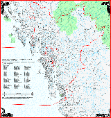
The atlas is atool that the Heiltsuk can use at all levels, whether it be foreducation, research initiatives or for simply cataloging information forfuture generations. Showcased here on the Aboriginal Mapping Network isone map from the forest series of the atlas.
|
Click on map to see larger version |
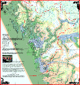
In the four corners of the map, you will see the four crests of the Heiltsuk Nation: the Eagle, the Raven, the Killer Whale, and the Wolf. Designed by local artist Walden Marty Windsor, these crests represent the hereditary structure of the Nation. Presented on the maps, these crests help to ground the work in the community and to show respect to the Chiefs.
From an information management perspective, this project has helped to organize, store and archive information in an efficient way. And it has also been a learning process.
"One of the most important things we’ve learned is the power of networking with other First Nations and organizations who have already worked on similar projects. This helps to avoid duplication and build important relationships in this field", says Reid. "You also have to have a vision of how the final product will be used. This helps you prepare the data according to the end needs. For example, if it’s to be used an as educational tool, it has to incorporate data that is accessible to youth."
 |
Click on maps to see larger version |  |
The atlas project is a success, and its success is in no small way attributed to the dedication to the project by Bo Reid and the Heiltsuk leadership.
"I think commitment is a big factor in the success of projects. Despite the closure of our treaty office, our community has recognized the value of our mapping office and has kept the mapping office alive. This is one small step in how we are rebuilding our Nation" says Bo Reid.


