By Russell Collier
The Conservation Technology Support Program (CTSP), has recently announced the CTSP 2000 grantees, and among them are two BC First Nations. Every year since 1995, a group of sponsors have donated GIS hardware and software to groups that can demonstrate a commitment to conservation objectives. This year, the Sliammon Treaty Society and the Gitxsan Strategic Watershed Analysis Team were among 31 groups receiving the Basic Grant. Both are known for their innovative approaches to planning and mapping for their respective territories.
CTSP (www.ctsp.org) makes GIS grants annually to approximately 50 organizations that can demonstrate a strong commitment to conservation objectives, compelling reasons to use GIS in achieving those objectives, and the organizational capacity (budget and people) to use GIS effectively over a long period of time. Grants vary in type and content. This year, the 65 total grants breakdown is as follows:
- Basic Grants: 31
- Special Equipment Grants: 26
- Software_only Grants: 8
- International grantees: 12 grantees from 8 countries
- Domestic grantees: 53
There is some overlap between grant types – one group might qualify for both a Basic and a Special grant, for instance, or be counted as both Basic and International.
What’s in a grant? It can vary, as it depends entirely upon the local  group’s needs and capacity. Typically, however, a Basic grant will consist of GIS-capable hardware from Hewlett-Packard (HP), GIS software from
 ![]() Environmental Systems Research Incorporated (ESRI), an operating system from Microsoft, and possibly GIS software from Clark Laboratories.
Environmental Systems Research Incorporated (ESRI), an operating system from Microsoft, and possibly GIS software from Clark Laboratories.
Special grants can contain hardware items such as plotters, printers, and high-end workstations running Unix and Arc/Info.
The hardware will usually consist of medium to high-end NT platforms with moderately high capabilities. The software will usually contain PC-Arc/Info and Arcview, and the operating system is usually Windows NT. Sometimes the GIS software received is IDRISI, a GIS developed originally for university students, but gaining popularity for its lower purchase price.
Sliammon Nation
The center of the Sliammon Nation is where the town of Powell River is located today. The 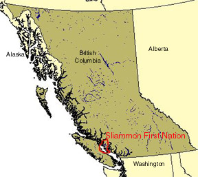 Sliammon goal is to develop an institutional structure for land and resource management that effectively integrates traditional knowledge with scientific and technical knowledge. This will allow the Sliammon First Nation to implement sound principles of land and resource management that reflect the unique traditional relationship between Sliammon people and the land and marine resources of the territory. The development of this institutional structure for land and resource management will be challenged in phases and will reflect the increasing demands placed on the GIS team as the Sliammon land base is acquired and affirmed through the British Columbia Treaty process. This institutional structure will grow into the future and play an integral role in planning sustainable development of Sliammon lands and resources.
Issues of cultural and environmental survival are driving the need to utilize appropriate technologies to focus on sustainable development and integrated resource planning. Integrated resource planning and environmental balancing have always been at the heart of First Nations’ culture. Geographic Information Systems (GIS) technology provides an opportunity to apply a process of assembling information to make well-informed decisions around land and resource use. It is a practical tool to facilitate addressing complex and technical issues cost-effectively while supporting the advancement and parity of First Nations people. For Sliammon, GIS technology will facilitate the attainment of their conservation mission.
Through the application of GIS technology, the Sliammon Treaty Society has completed traditional occupancy and use maps, which consolidate all research done on traditional use of lands and resources in the territory. One of the most important sources of information for these maps has been oral history interviews completed with Sliammon elders from 1970 through 1999. The Sliammon Treaty Society’s traditional coordinator, Hew’kin (Joe) Mitchell, played a key role in carefully reviewing and guiding the involvement of the Sliammon elders in this important project.
The purpose of the Sliammon Traditional Use Study (TUS) was to create a comprehensive inventory of traditional occupancy and use of Sliammon lands and resources to support participation in a BC Treaty Process and the Crown Lands Referral Process. This was a very defined focus for the traditional occupancy and use research, but it fits within the broader goal of the Sliammon community — to document Sliammon history from the perspective of the Sliammon people. It is hoped that one day the Sliammon First Nation will have a cultural center to house all the information that was collected through this study. The information is invaluable for use in education curriculum for the local school district and in creating a sense of pride and cohesion in the Sliammon community.
The Gitxsan
The centre of the Gitxsan Nation is the Hazelton area, along the Skeena River. The Gitxsan are comprised of 6 villages, 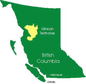 Gitwangax, Gitsegukla, Gitanmaax, Kispiox, Glen Vowell, and Gisgega’as. The Gitxsan are probably known best for being one of the two nations who brought about the Supreme Court of Canada ruling called the "Delgamuukw Decision". The other nation was the Wet’suwet’en, their close neighbours and friends. This landmark legal victory underlies all the Gitxsan Nation’s land management planning.
Like the Sliammon, the Gitxsan use GIS to incorporate TUS information into negotiations and referrals processes. And like the Sliammon, the Gitxsan are interested in both sustainable economic development and in protecting natural resources critical for the survival and growth of their nation. However, the Gitxsan have decided to develop an overall approach for their entire territory first.
The Gitxsan are using a technique called ecosystem-based mapping. Basically, they identify plant, animal, and cultural features, and then map the areas required to sustain these features. Like the Sliammon, the Gitxsan recognised forestry and, to a lesser but still significant degree, fishing, as key components of any economic growth for their people. Human uses, such as hunting, logging, transportation, non-timber forest products are also mapped, adding to the layers of information.
Central to the Gitxsan approach to Crown Lands Referrals is the concept of informed consultation. Central to the Gitxsan approach to land claims negotiations is the concept of demonstrably sustainable economic development. This means every Gitxsan entering into either the referrals processes or negotiations has the right to sufficient information to make informed decisions. Sufficient information to a Gitxsan means they should have enough information to judge how much habitat is being impacted, how much is left, what is critical, and what can be rehabilitated. In all cases, there is an onus to show sustainability, whether it is a provincial forestry operation or a Gitxsan operation.
The CTSP Grants & First Nations
What’s important about these two nations receiving major GIS grants from CTSP is not so much which approach they use – there is room for experimenting and learning from each other, and from the many other First Nations across BC who are also tackling difficult lands and resources management challenges. What’s important is that BC’s First Nations have the capacity, by virtue of being in land claims negotiations, to re-write many of the fundamental rules for resource use and management in this province. First Nations have a profound relationship with their land. They have no fear of using resources. BC is a generous place, if allowed to recover from development impacts. However, BC First Nations, including the Sliammon and Gitxsan nations, also maintain that along with the right to use resources comes a corresponding responsibility to protect the habitats of the plants and animals that share the land with us all, that it is a special responsibility of each First Nation to speak for those lives that cannot speak for themselves. And GIS, as tool, fits very well for each of these two nations, so they can articulate not just land area and jobs, but also ethics and longevity.