“After all, the border is artificially imposed”
NATIVEMAPS.ORG
Networking the Aboriginal Mapping Community in British Columbia
By Roman Frank and David Carruthers
“Great site you’ve got set up! Feel free to e-mail information that might pertain to Tribal GIS down here – after all, the Canada/US boundary is artificially imposed. I’ll let our members know of your website so they can bookmark it.” This excerpt from an e-mail from Tom Curley, the GIS Program Manager for the Suquamish Tribe, is one of many feedback messages received during the past two years on the Aboriginal Mapping Network. In a way, this simple e-mail message goes right to the heart of what the network is all about: breaking down artificial barriers and sharing experiences with others throughout the aboriginal mapping community.
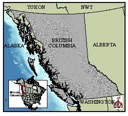 Two years ago, at a round table discussion after a GIS conference in Vancouver, several aboriginal mapping leaders stood up and voiced their concern that First Nations in British Columbia are all investing into GIS technologies in isolation – cut off from each other and unable to learn from each other. A formalized network was needed, and it was needed right away.
A small group of people got together to make it happen. Russell Collier of the Gitxsan Nation, Roman Frank of the Ahousaht Nation, and David Carruthers of Ecotrust Canada contracted a University of British Columbia student, Ben Johnson, to conduct a needs assessment, to help identify the building blocks of the network. After a lot of feedback and consultation, it was decided that the network would be comprised of four different activity areas: (1) a web page of resources, stories and links; (2) an annual conference to help bring people together; (3) a publication series addressing common themes identified by network participants; and (4) informal round table workshops throughout the year. On June 21 (National Aboriginal Day in Canada), 1998, the network sprang to life.
The AMN web site (www.nativemaps.org) hosts a wealth of information including data sources, training resources, funding information, and methods for mappers. As the AMN is designed to be a forum for sharing ideas through interactive media, we have also created a moderated LISTSERVE where participants discuss issues and ideas with each other via e-mail. The site is very dynamic, with updates posted weekly. The number of hits has been steadily increasing, to an average of 2,500 hits per month.
At the annual international GIS conference First Nations are able to present mapping issues on First Nations terms. The agendas for large mapping and GIS conferences are usually set by industry or government, and rarely address issues from a local or First Nations perspective. In March 1999, the AMN hosted the first two day First Nations GIS conference in Vancouver. In all, we had around 80 native participants attend, with panel presenters from across Canada and as far off as Barrow, Alaska and Australia. A First Nations committee oversees the conference planning and they have set the 2000 conference for late fall in Vancouver.
 Our publication series of “best practices” is designed to help fill the void of good reference materials dealing with First Nations and cultural applications of mapping. To help meet the increasing demand for such products, we have joined together with the Union of B.C. Indian Chiefs to co-produce the series. The publications are peer reviewed, and written and formatted in accessible and informal mediums. A multi-disciplinary, cross-cultural advisory group is being set up to help select new themes, topics and authors for the series. Our first publication, due for release this coming summer, is a full-colour book by Terry Tobias which examines common pitfalls encountered by First Nations while designing and implementing cultural land use studies, and offers clear guidance on how these problems can be avoided. The publication will be distributed at cost through the Chief’s Mask Bookstore in Vancouver and will be available for free in PDF format on the Internet through the Aboriginal Mapping Network web site.
The informal roundtable workshops are focused on topics that surface within the network. To date, we have hosted three workshops, bringing together over 45 First Nation mappers from around the province to hash out issues such as bringing traditional use information into a GIS, using mapping technologies to respond to development plans and modeling wildlife areas for First Nations applications.
Unlike industry or government’s gradual embrace of GIS technologies, First Nations aren’t being given the time to adapt the technology for local applications. There is currently intense pressure for native groups in the province to “hit the ground running” and become proficient with GIS tools overnight. Whether it be for treaty negotiations, litigation, cultural or resource management applications, First Nations are becoming creative in how to deal with these pressures, adapt the technology and tell their own stories through maps. The Aboriginal Mapping Network is becoming the forum of choice in the province to help make this happen.
For more information on the Aboriginal Mapping Network, please visit www.nativemaps.org or write to the Aboriginal Mapping Network Coordinator at: info@nativemaps.org.